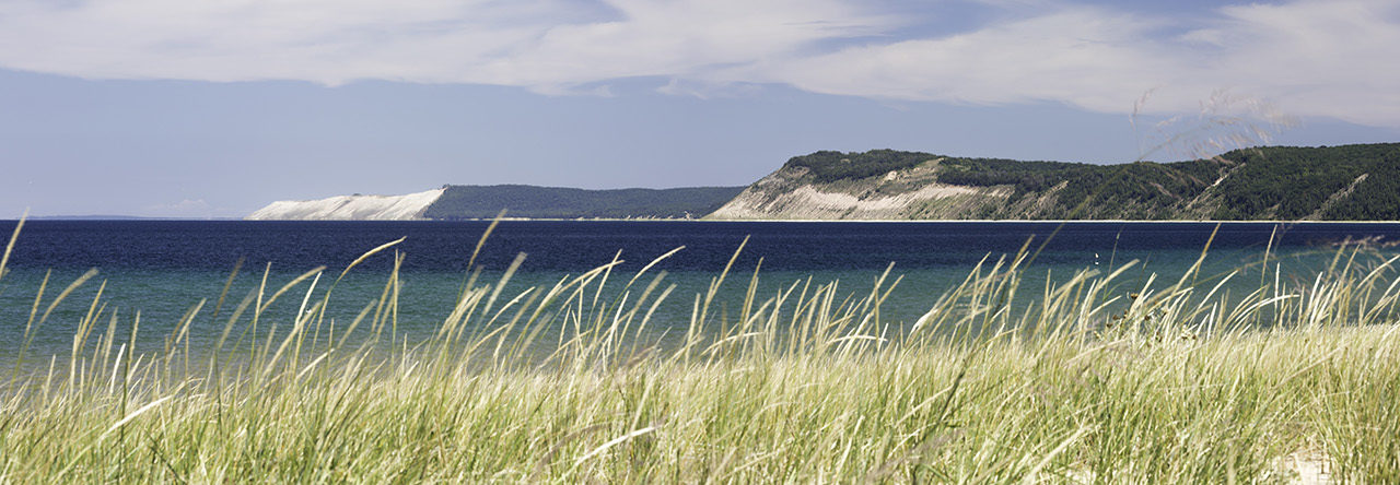
The next section of trail followed the White Pine Trail State Park for about 7 miles between Rockford and Cedar Springs. This is a paved rail trail that parallels the Rogue River for a while and then passes through a mixed suburban/rural landscape. I cheated a bit and rode my bike on this section. I prefer a more natural landscape, so the highlight for me was a brief diversion into the Maas Family Nature Preserve.
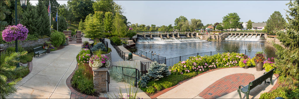
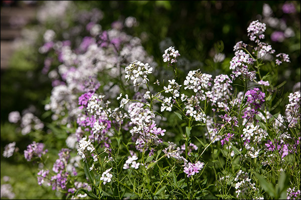
The North Country Trail follows the White Pine trail beginning just north of the dam on the Rogue River in Rockford.A cheery hedge of Dame’s Rocket lines the trail just north of Rockford. This is yet another introduced species that has escaped gardens and become naturalized.
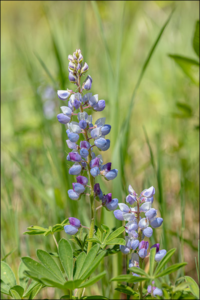
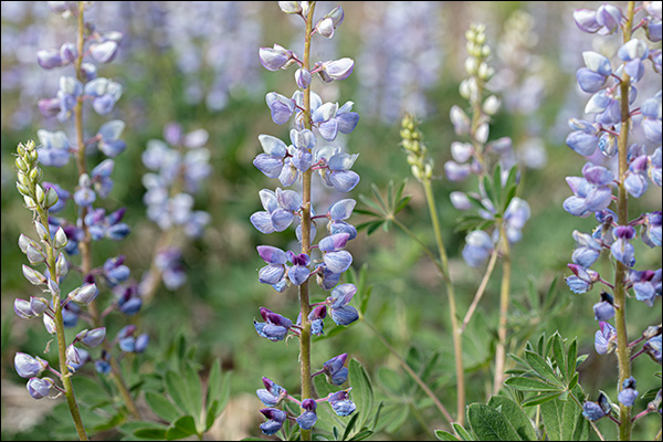
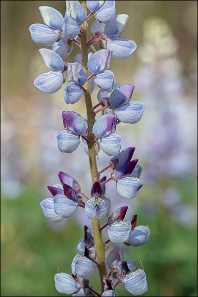
The Maas Family Nature Preserve is managed for its healthy carpet of Wild Lupine, which is the only food for the caterpillar of the endangered Karner Blue butterfly.
Today I hiked a section of the North Country Trail that follows the Cannon Township Trail, a paved multi-use trail. The trail passes through some nice woodlands, an extensive wetland, and past suburban developments. It’s the kind of landscape where you often encounter introduced species. I’m not enough of an naturalist to always know if something that catches my eye is a native or introduced species. So it’s always a bit of a disappointment when I discover later that some beautiful things are thriving where they really don’t belong.
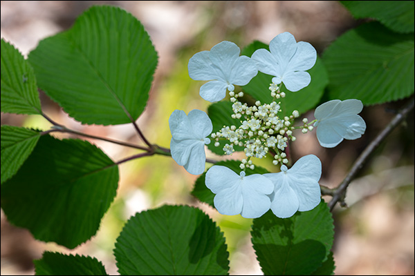
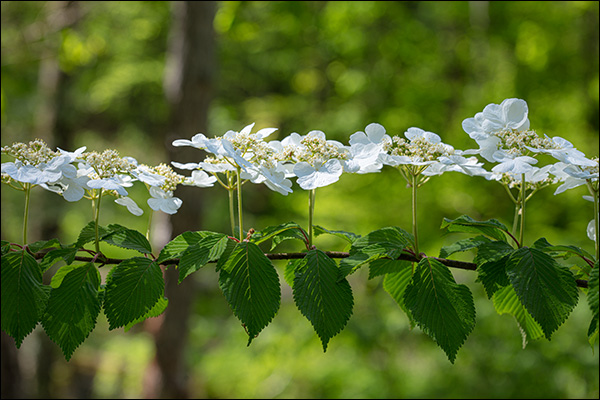
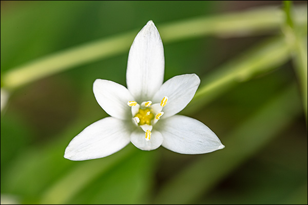
Though resembling native viburnum species, Japanese Snowball is an introduced species that had established itself sporadically in a few southern counties in Michigan.Star-of-Bethlehem is an introduced species of Lily native to eastern Europe and parts of the Middle East. I found this growing just outside the historic Cannonsburg cemetery.
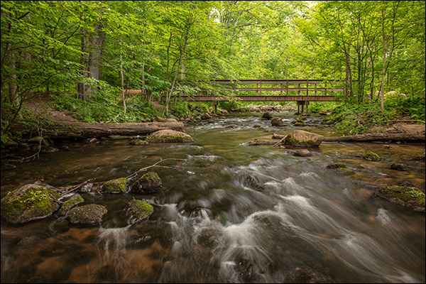
A bridge carries the North Country National Scenic trail over Honey Creek through Seidman County Park near Ada, Michigan.
The next section of trail took me through Seidman County Park north of Ada, Michigan. After crossing Honey Creek at the southern end of the park, the trail loops through diverse terrain of wetlands and forest for a little over two miles. In one clearing I came across a nice patch of wild lupine.
Wild Lupine grow in a sandy patch along the North Country National Scenic Trail that passes through Seidman County Park near Ada, Michigan.
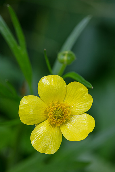
The shiny yellow flower of Swamp Buttercup grows along the North Country National Scenic Trail as it passess through Seidman County Park near Ada, Michigan.
Wild Lupine grows in a sandy patch along the North Country National Scenic Trail as it passess through Seidman County Park near Ada, Michigan.
After crossing to the western bank of the Flat River at the northern edge of Fallasburg County Park, the North Country Scenic Trail continues north through another half mile of protected woodland. The first part passes through a wetland that has a nice selection of Spring wildflowers.
The North Country National Scenic Trail crosses the Flat River on a foot bridge at the north end of Fallasburg County Park near Lowell, Michigan.
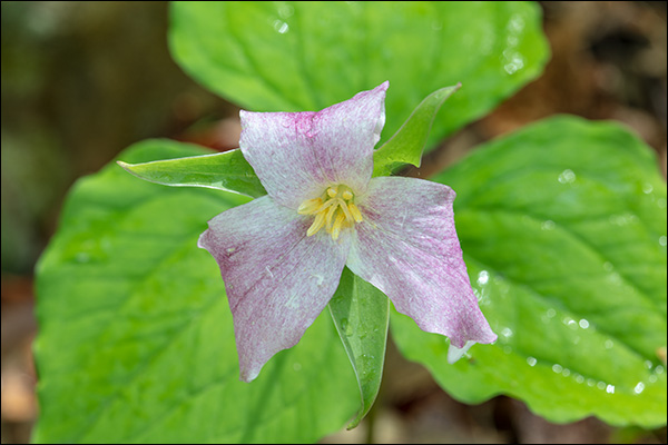
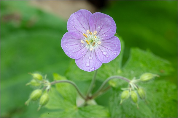
Trillium, Wild Geranium, and May Apple blossom along the North Country National Scenic Trail North of Lowell, Michigan.
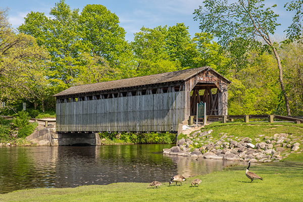
The next section of trail took me to Fallasburg County Park, just north of Lowell, Michigan. The trail passes through the tiny historic village of Fallasburg, and it’s worth a slight diversion to walk through the village to the historic Fallasburg Covered Bridge. The bridge is one of only two remaining historic bridges still serving their original purpose in Michigan.
A well worn path along the North Country Scenic Trail just north of Lowell, Michigan
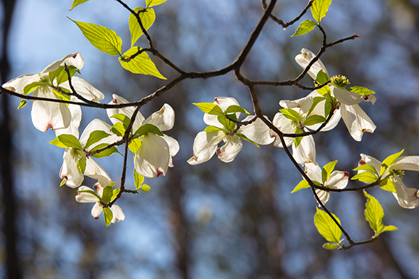
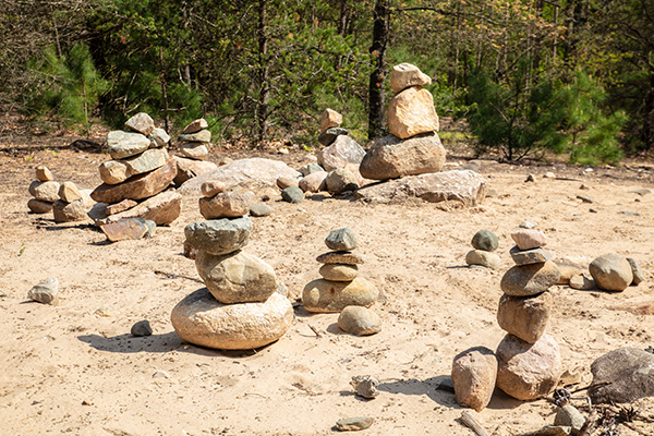
The large white blossoms of the Flowering Dogwood add occasional accents to the tree canopy in spring woodlands in Michigan.A field of cairns in a clearing along the North Country Scenic Trail near Lowell, Michigan testifies to the popularity of ths stretch of pathway.The North Country National Scenic Trail passes through Fallasburg Park just north of Lowell. The Fallasburg Bridge, one of only two historic covered bridges left in Michigan, is just a short diversion from the trail.
I started my exploration of the North Country Trail on the northern edge of the small town of Lowell, Michigan. The trail parallels the Flat River passing through forests largely reclaimed from hardscrabble farms.
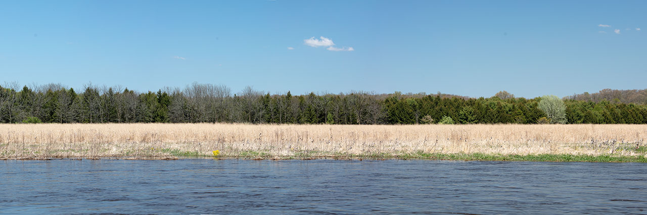
The Flat River flows through marshland just north of Lowell, Michigan.
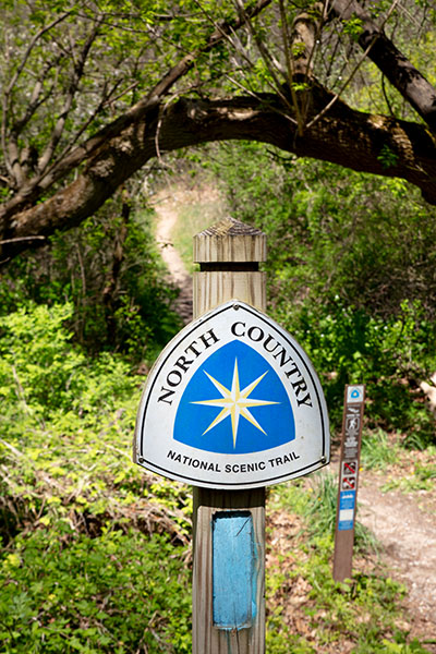
A sign marks the way along the North Country National Scenic Trail
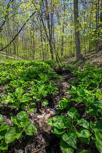
Skunk Cabbage proliferates along a stream flowing through a hollow alon g the North Country Trail near Lowell, Michigan
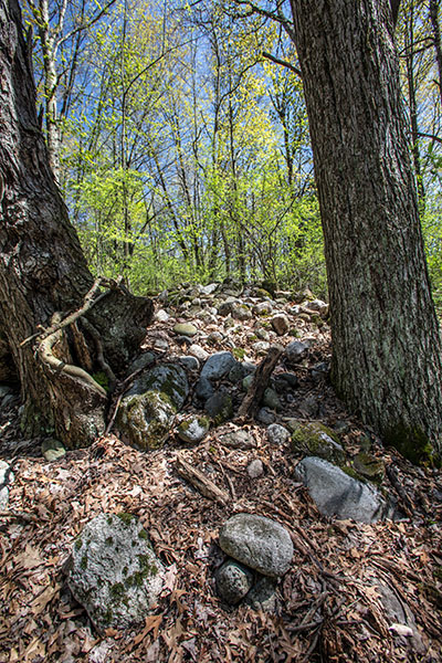
A large pile of stones is testament to the hard and ultimately futile work to clear land for agriculture now reclaimed by forest.
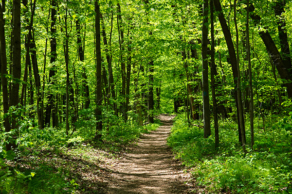
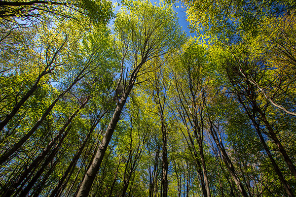
The forest canopy glows spring green on a sunny day.
In a normal year I’d be greeting customers at outdoor art fairs almost every weekend through the summer. But Covid-19 has forced the suspension of the art fair season this year. And so I’ve decided to take on a major project instead. I intend to explore as much of the North Country Trail in Michigan as I can and photograph whatever catches my eye.
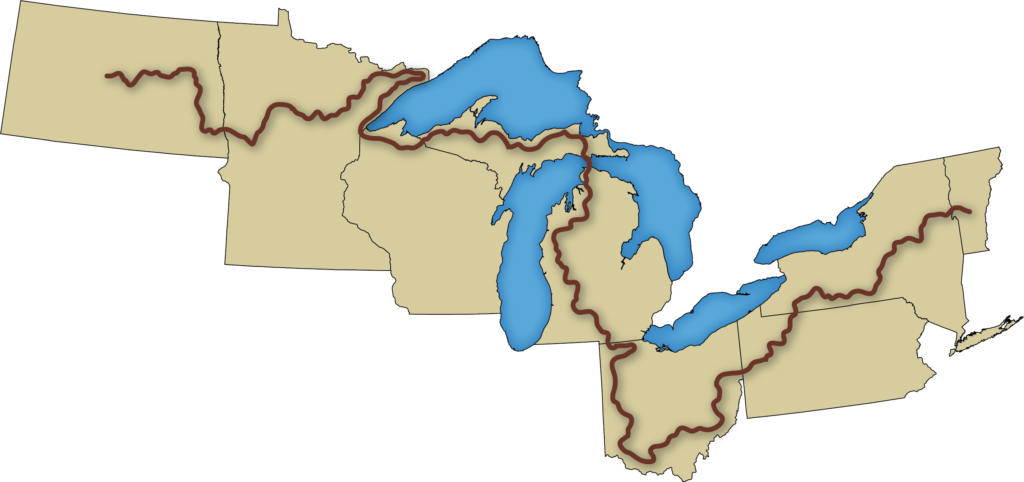
The North Country Trail is the longest of eleven National Scenic Trails designated by the National Park Service. It stretches 4,600 miles from Vermont through North Dakota. The State of Michigan is at its heart and hosts 1,150 miles of the trail. A fair portion of these miles are along lightly traveled roads, so I’ll just explore the miles of trail that pass through Natural areas.
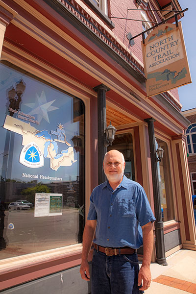
The North Country Trail Association is a non-profit organization that partners with the National Park Service to develop, maintain, protect and promote the trail. As it turns out their headquarters is in the small town of Lowell, Michigan, very near my home in Grand Rapids. So it seemed fitting to start my journey there and work my way north.